This post may contain affiliate links. As an Amazon Associate I earn from qualifying purchases, but there is no additional cost for you. Please see my Disclosure page for more information.
After the family reunion ended, we all scattered our different ways. My sister had told me about a seasonal waterfall that they’d tried to hike to before, but never managed because they were always in the area at the wrong time of year. We were heading that direction, so we decided to stop and see what we could see. My sister’s family had done lots of hiking that week, including the Narrows, the Subway, and Angel’s Landing, so they were pretty burnt out and decided not to try it.
They should have, though.
It was a bit longer than we anticipated, and definitely not our usual type of hike, but it was such a fun hike!
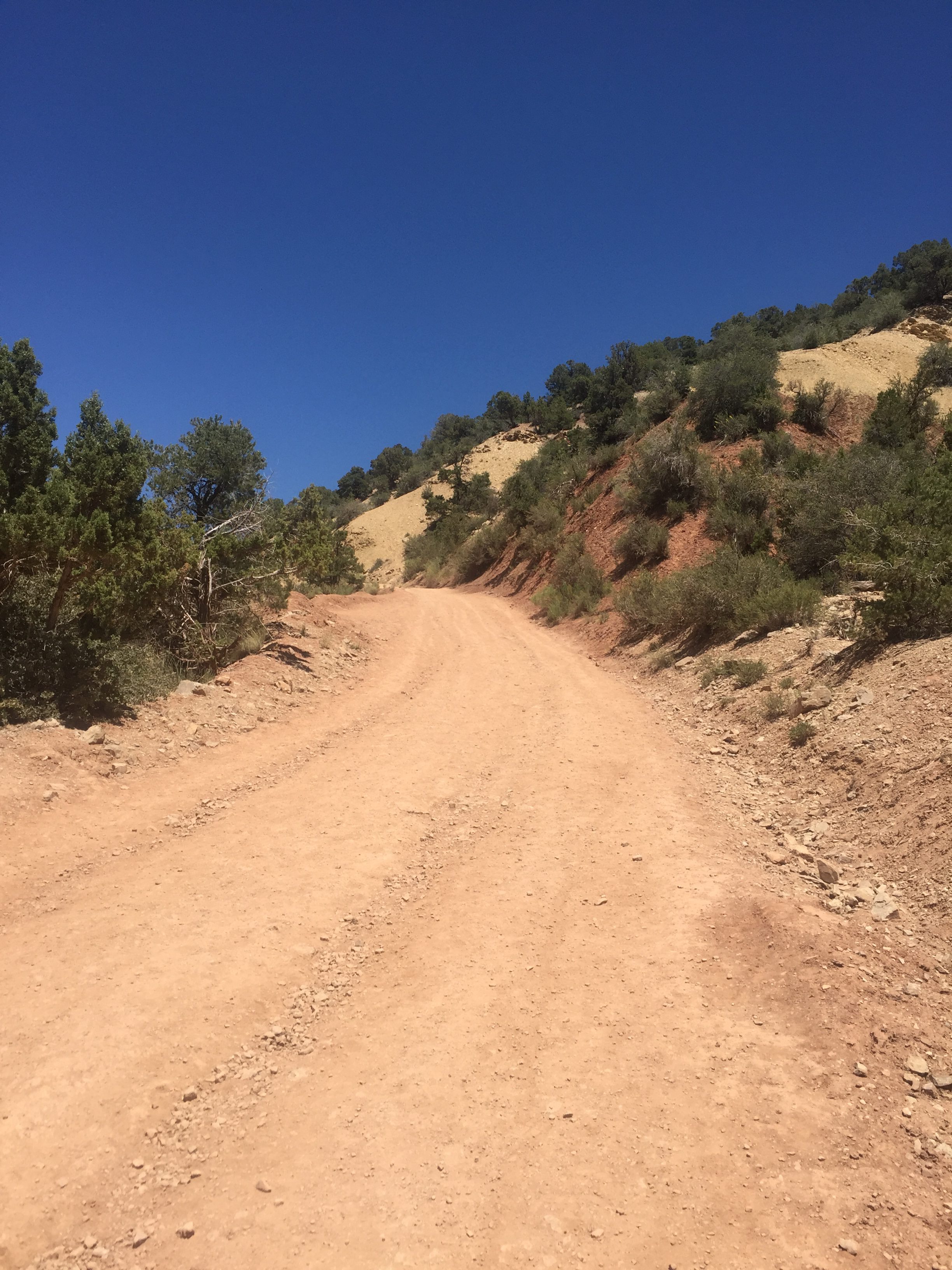
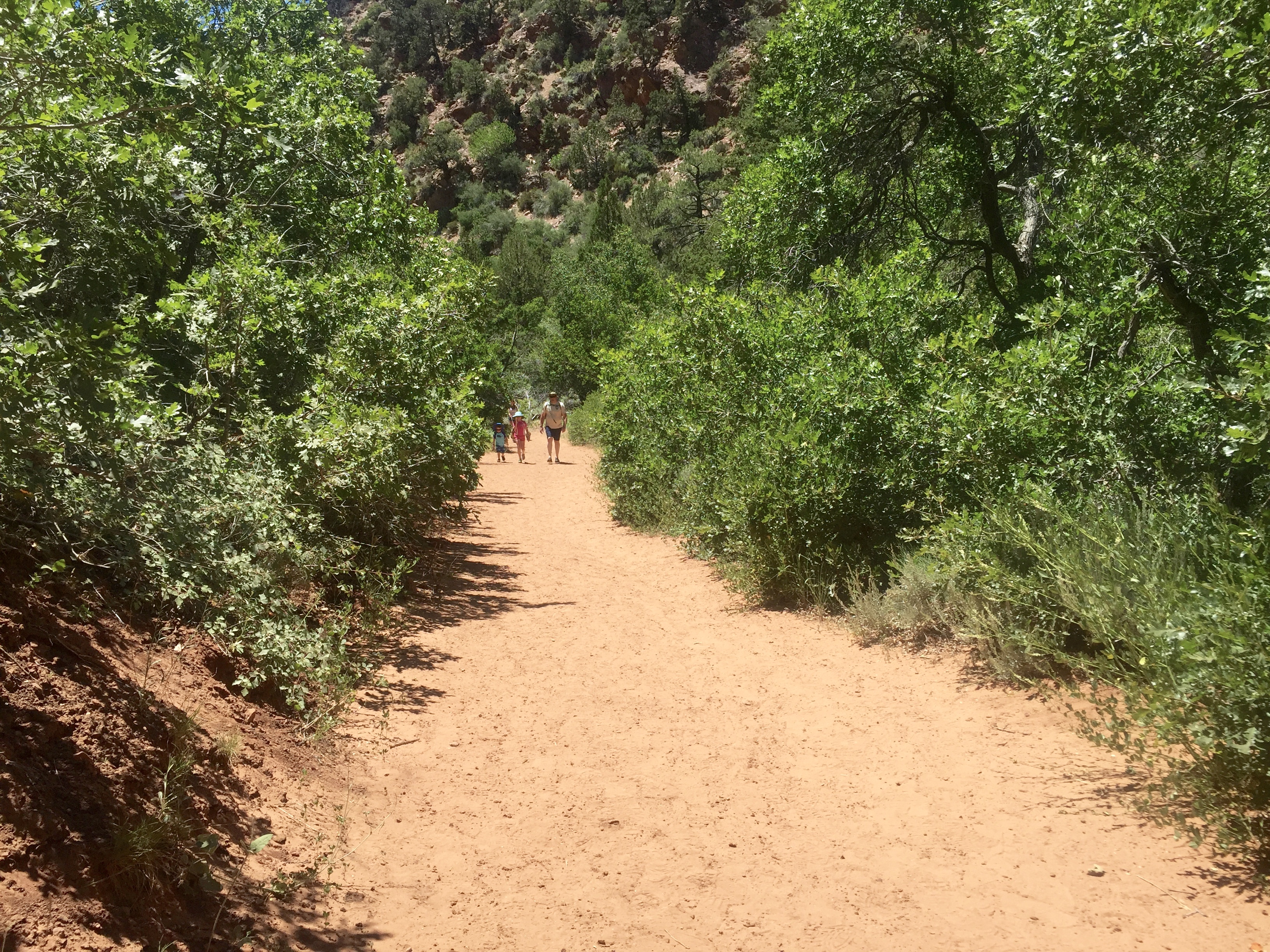
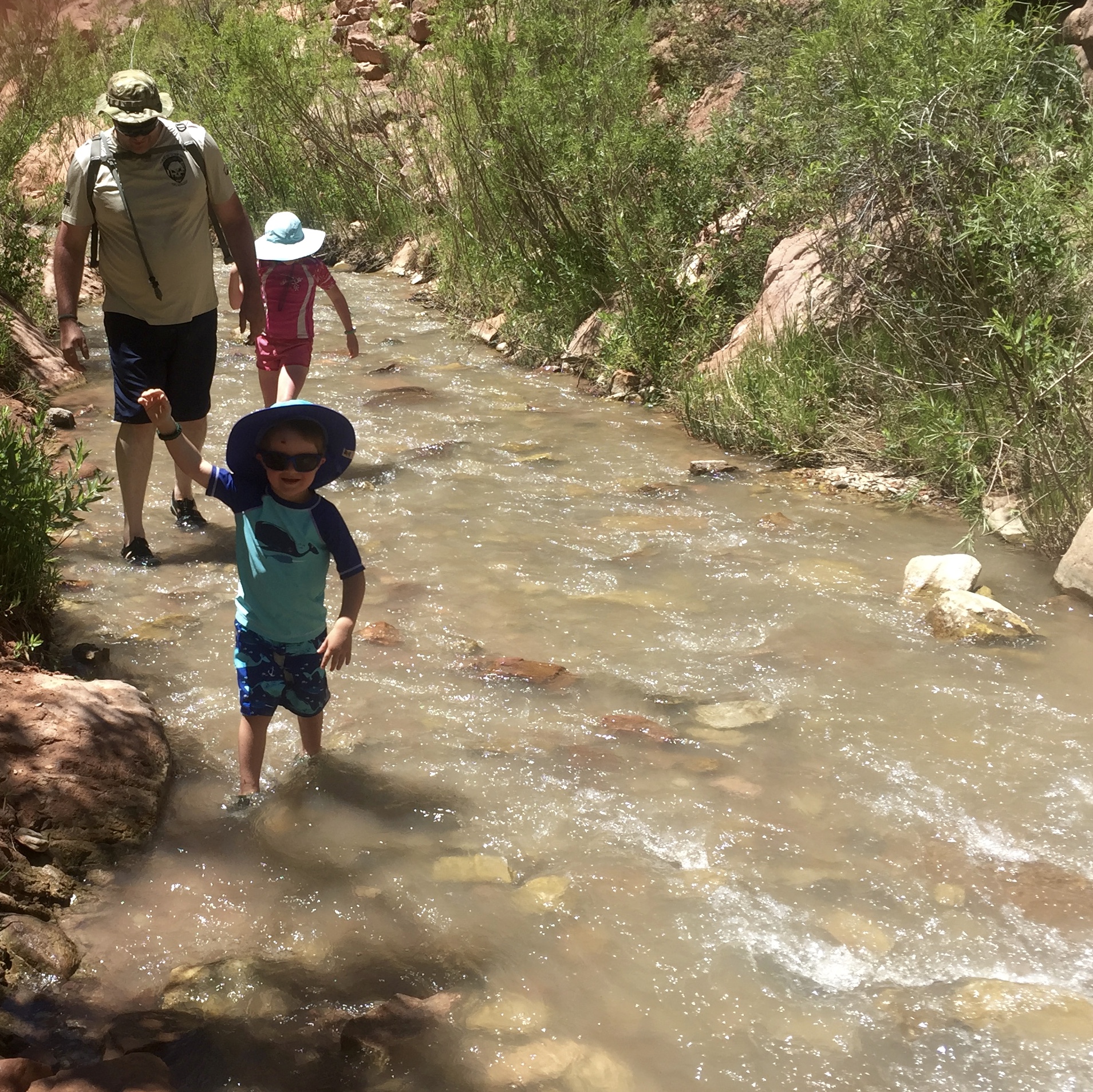
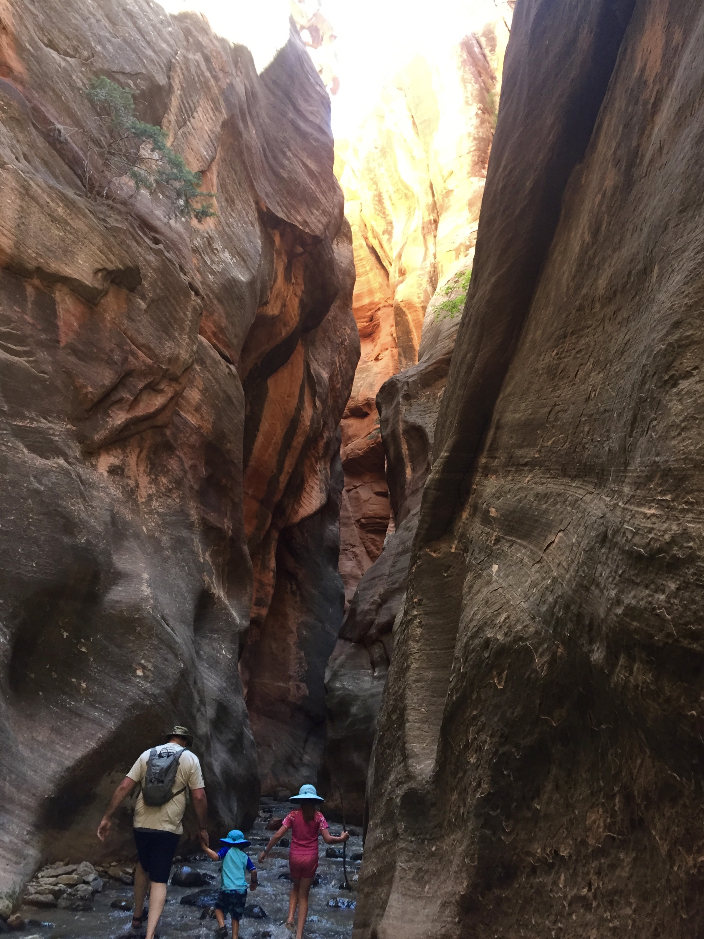
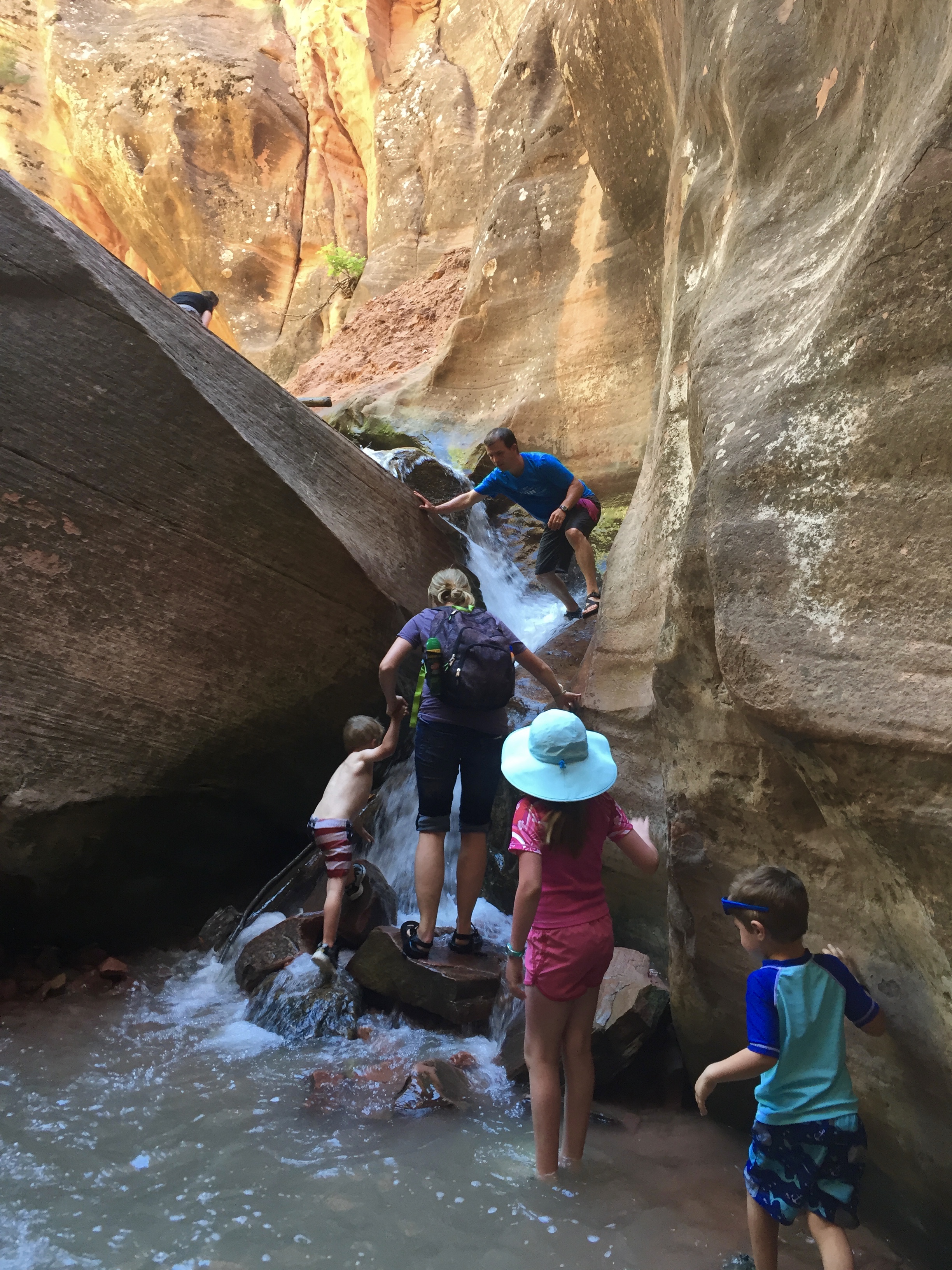
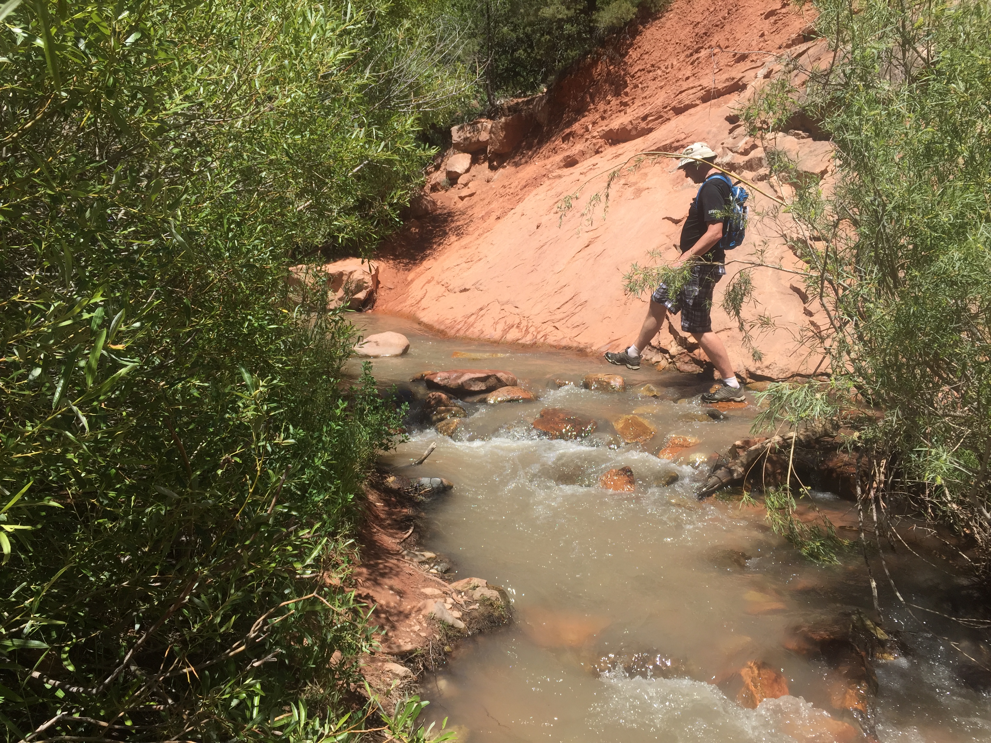
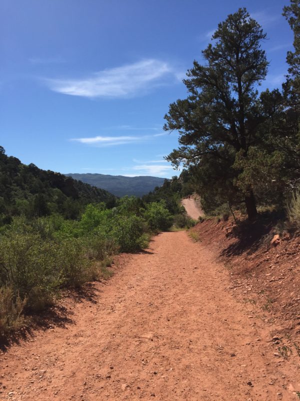
We started out walking for a bit more than a mile on a dirt service road. After about a mile the road became a narrow trail, but before that point we had several creek crossings that we had to splash through, and the icy water was a bit of a shock.
Once the trail narrowed, we were alternating between crossing the water, scrambling over the trail, and walking upstream in the water. Our feet quickly grew numb to the icy water and it just felt cold, rather than frigid. My plantar fasciitis had been aggravated by hiking up and down Angel’s Landing the day before, and the icy water felt really good on my poor feet.
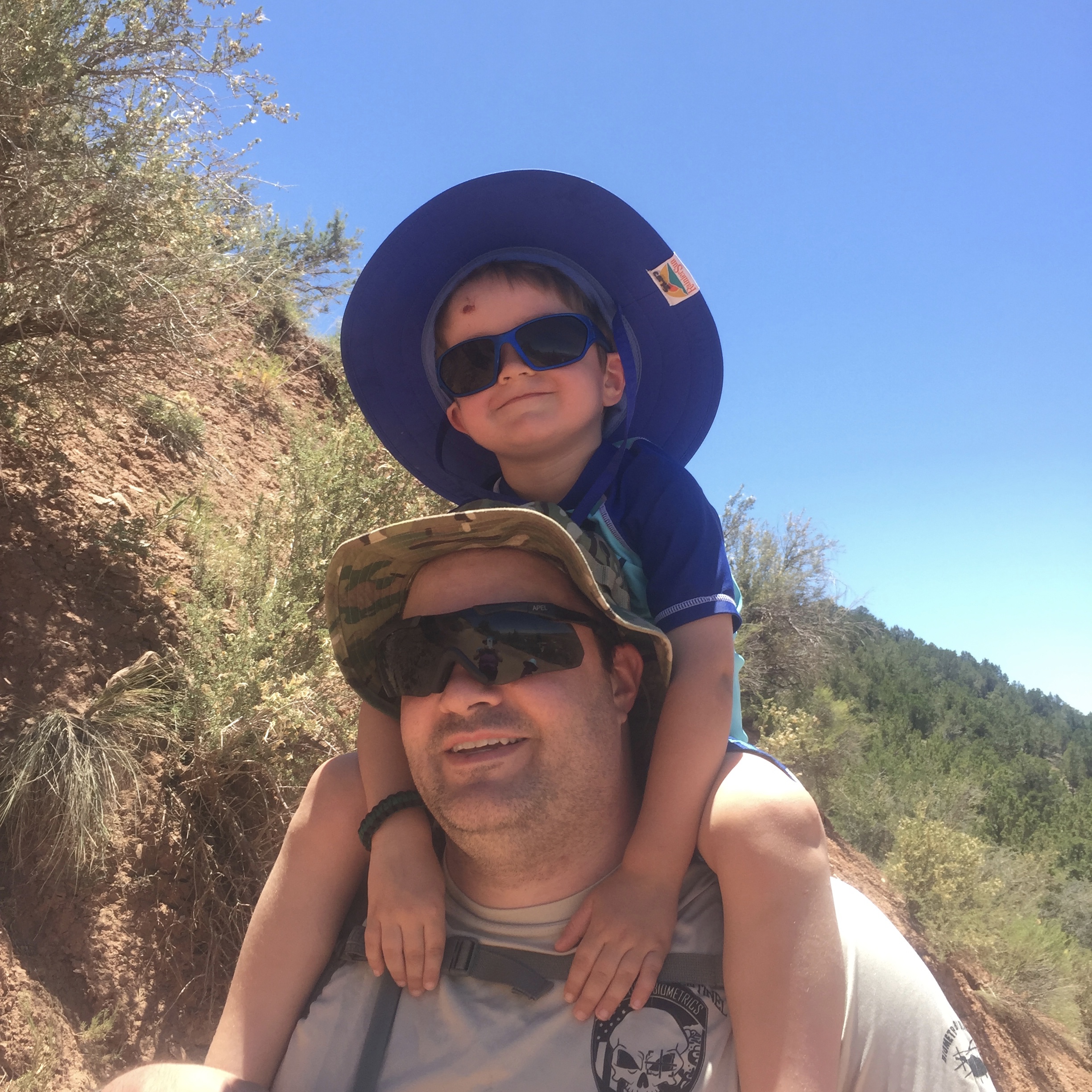
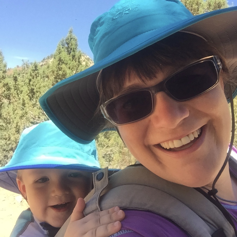
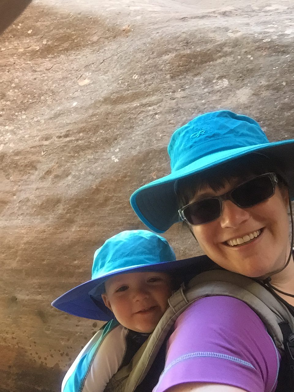
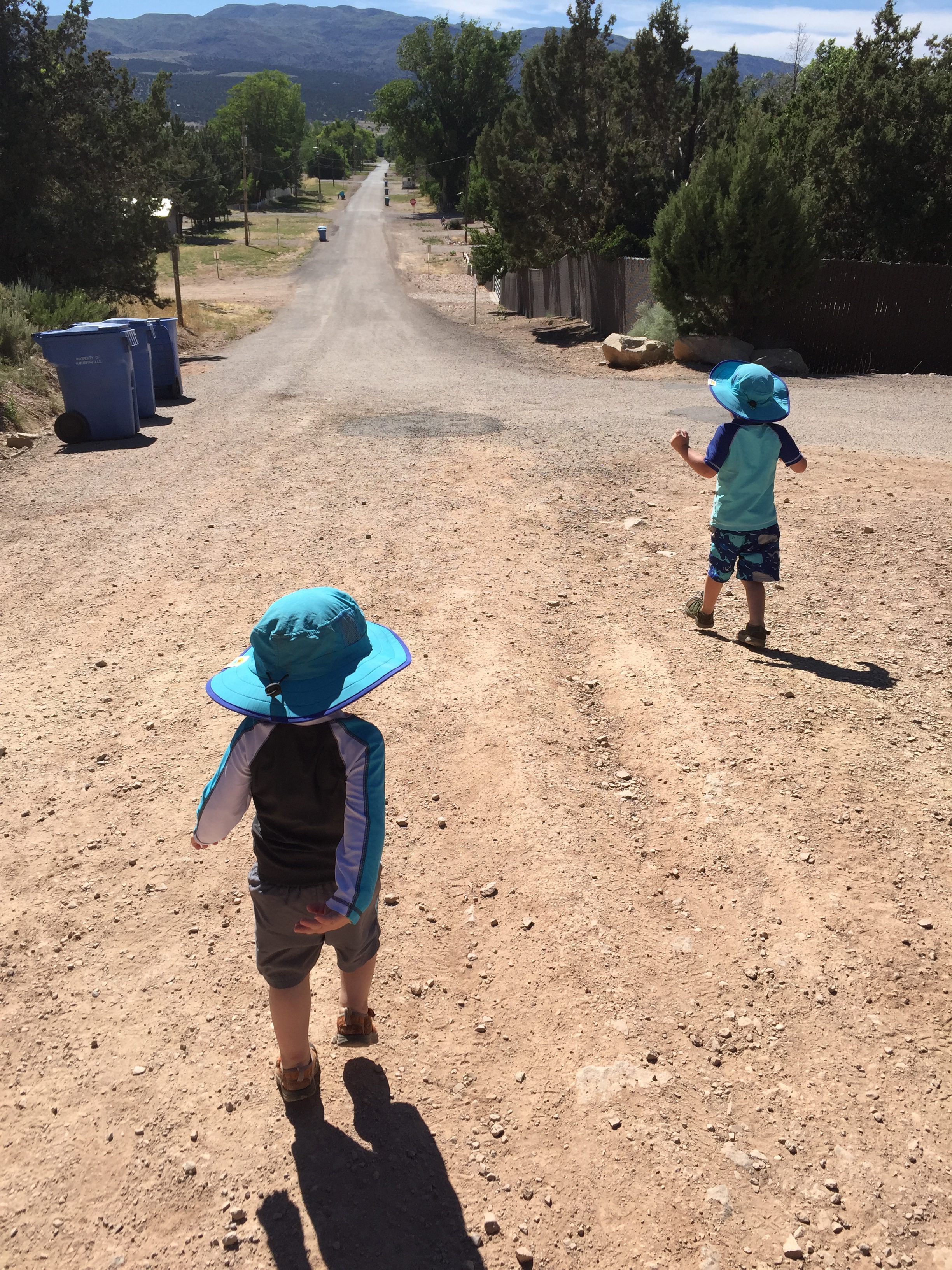
Ocean rode in the carrier on my back for the majority of the hike, Sunshine hiked all of it, and River hiked about two thirds of it, with Jeremy carrying him the rest of the time.
Heading up to the falls River was very positive and excited.
“You’re doing good!”
“I know! I got this!”
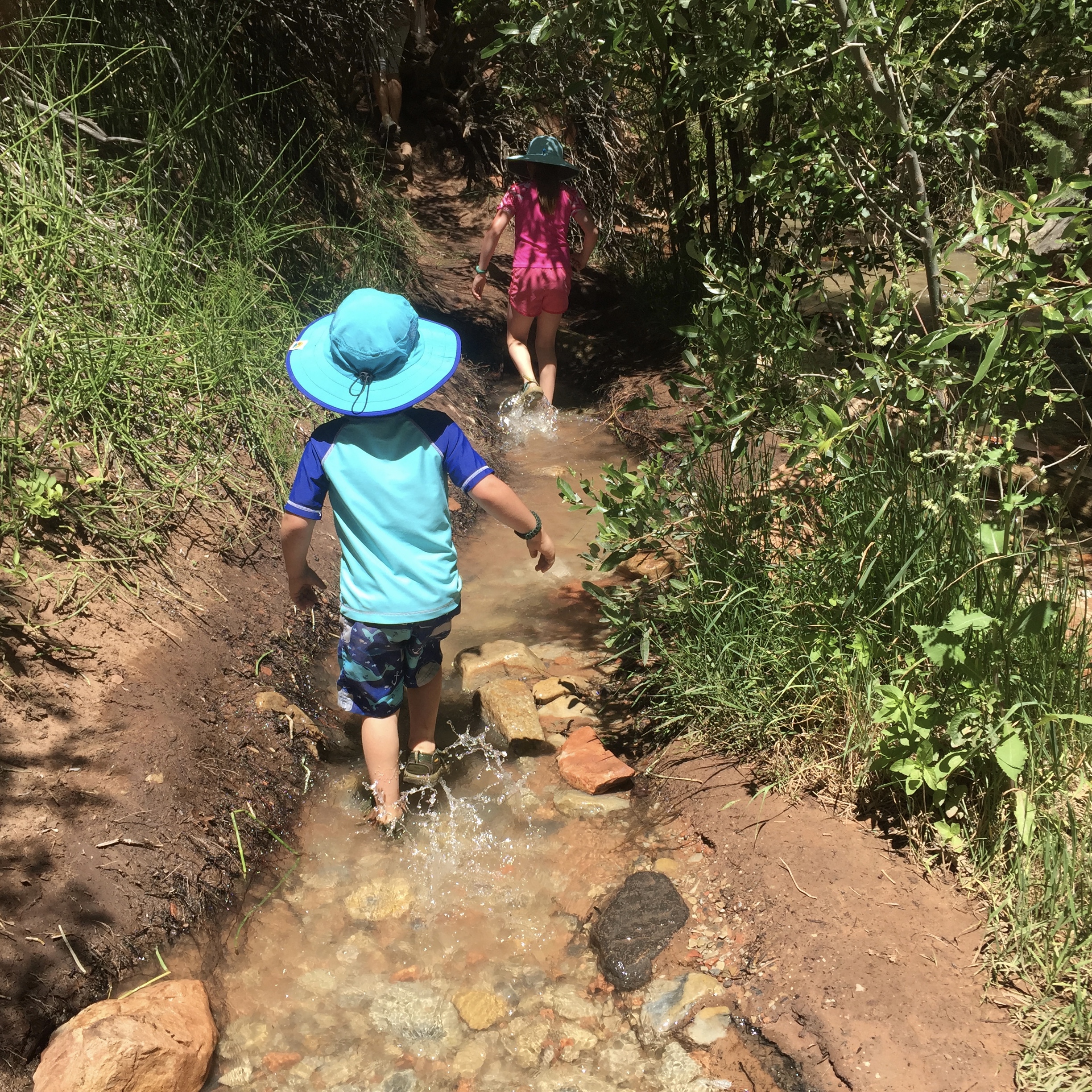
He scrambled over rocks and splashed in the water and did a great job of keeping up. Sunshine took the lead on more than one occasion, scouting out the best route to take.
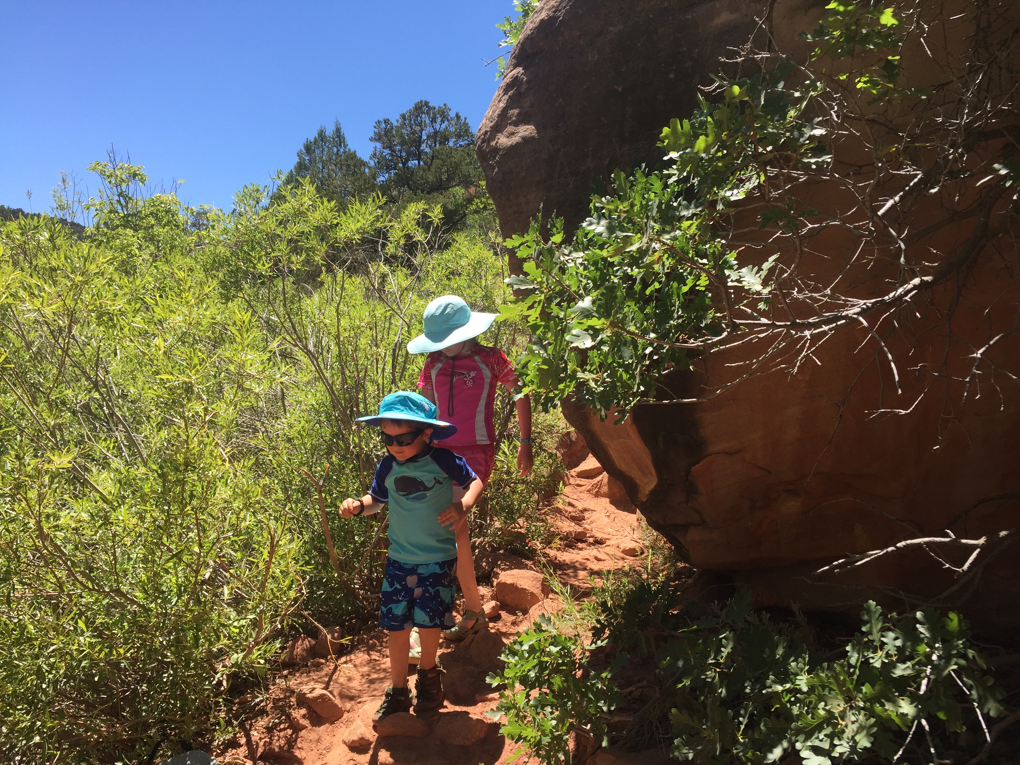
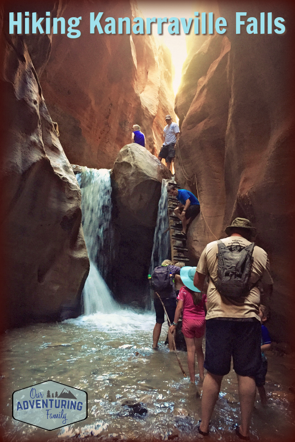
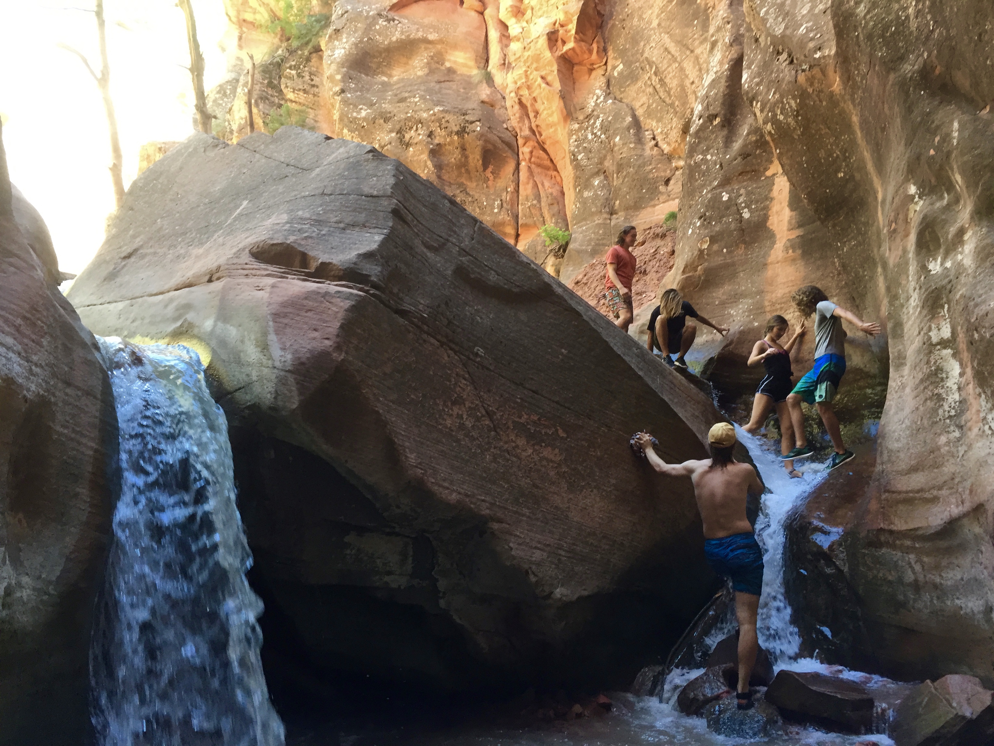
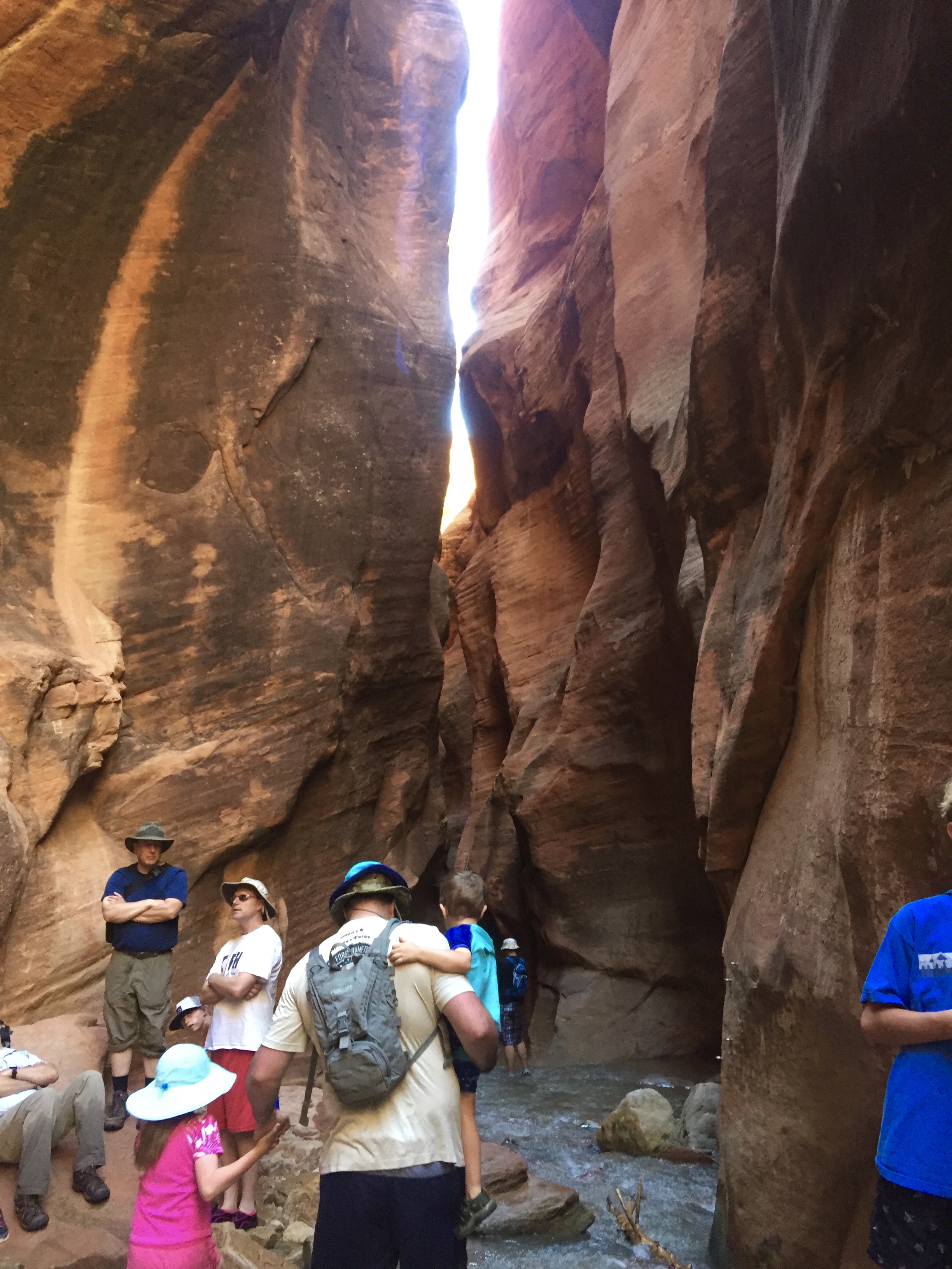
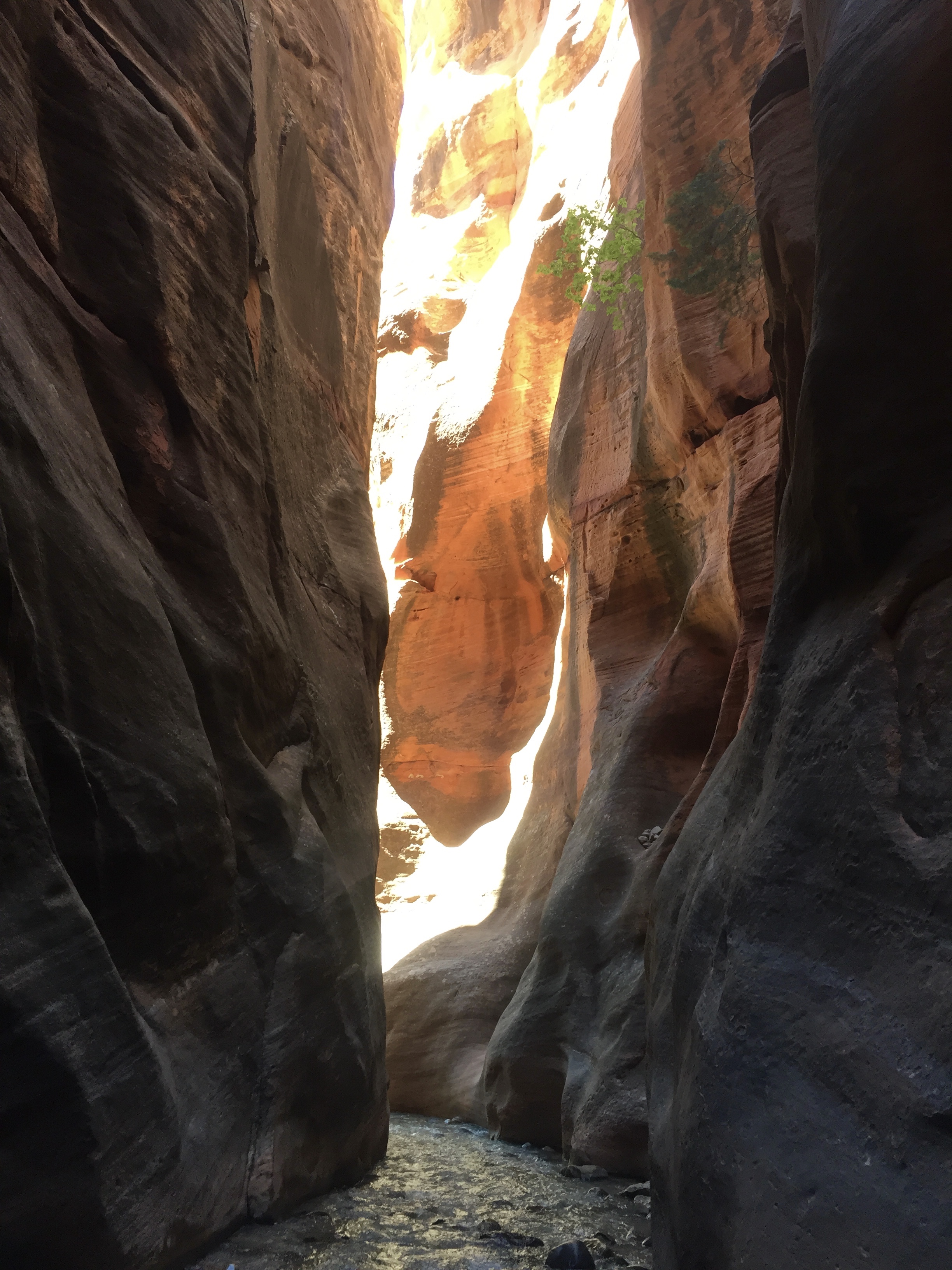
The trail is not marked at all, so we weren’t sure where anything was, other than we’d been told the first falls were 1.78 miles from the parking lot. A small falls briefly had us thinking we’d reached the lower falls, until we remembered that the lower falls are in a slot canyon and have a ladder. We kept going, and soon reached the slot canyon that led to the falls.
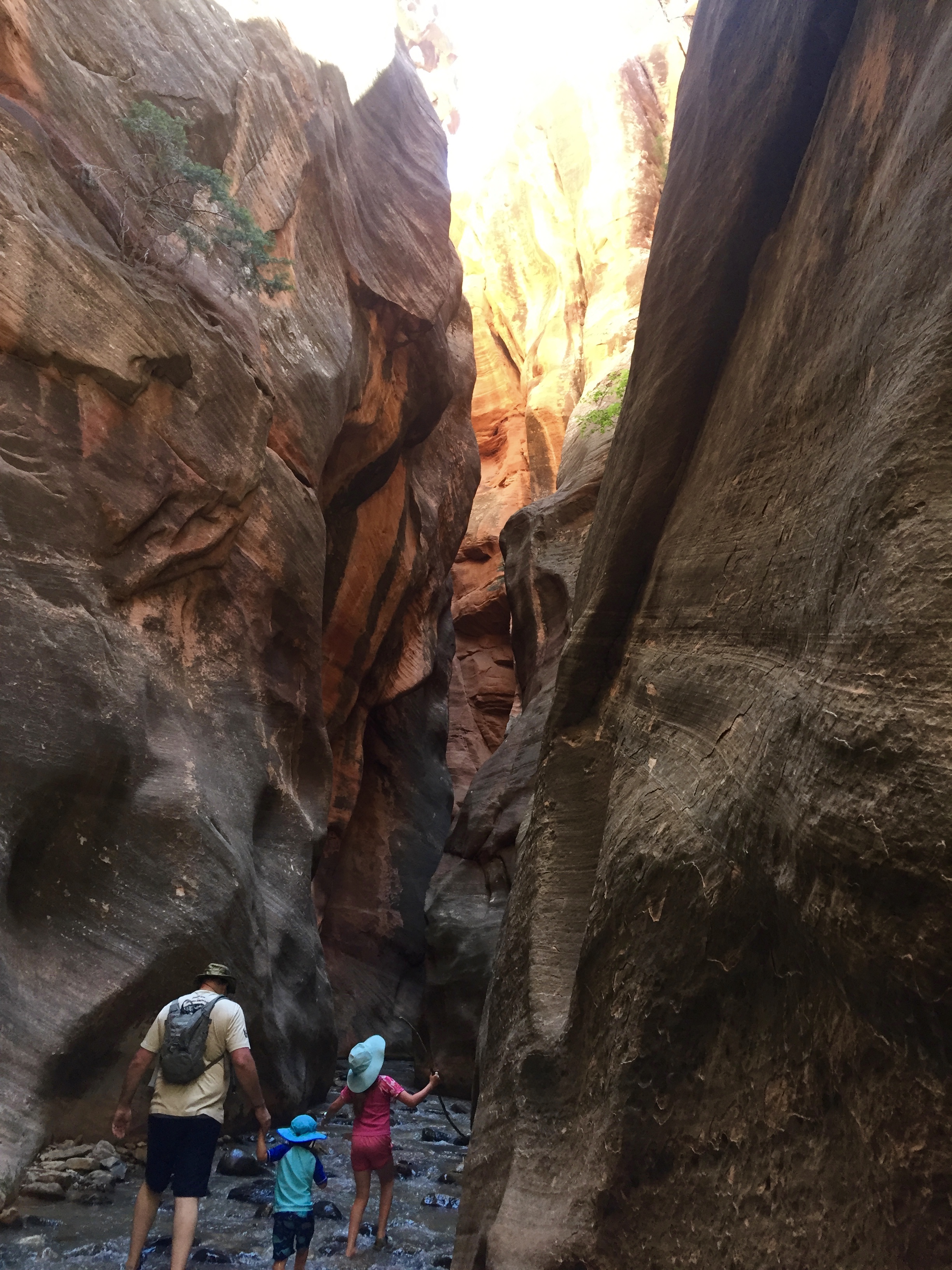
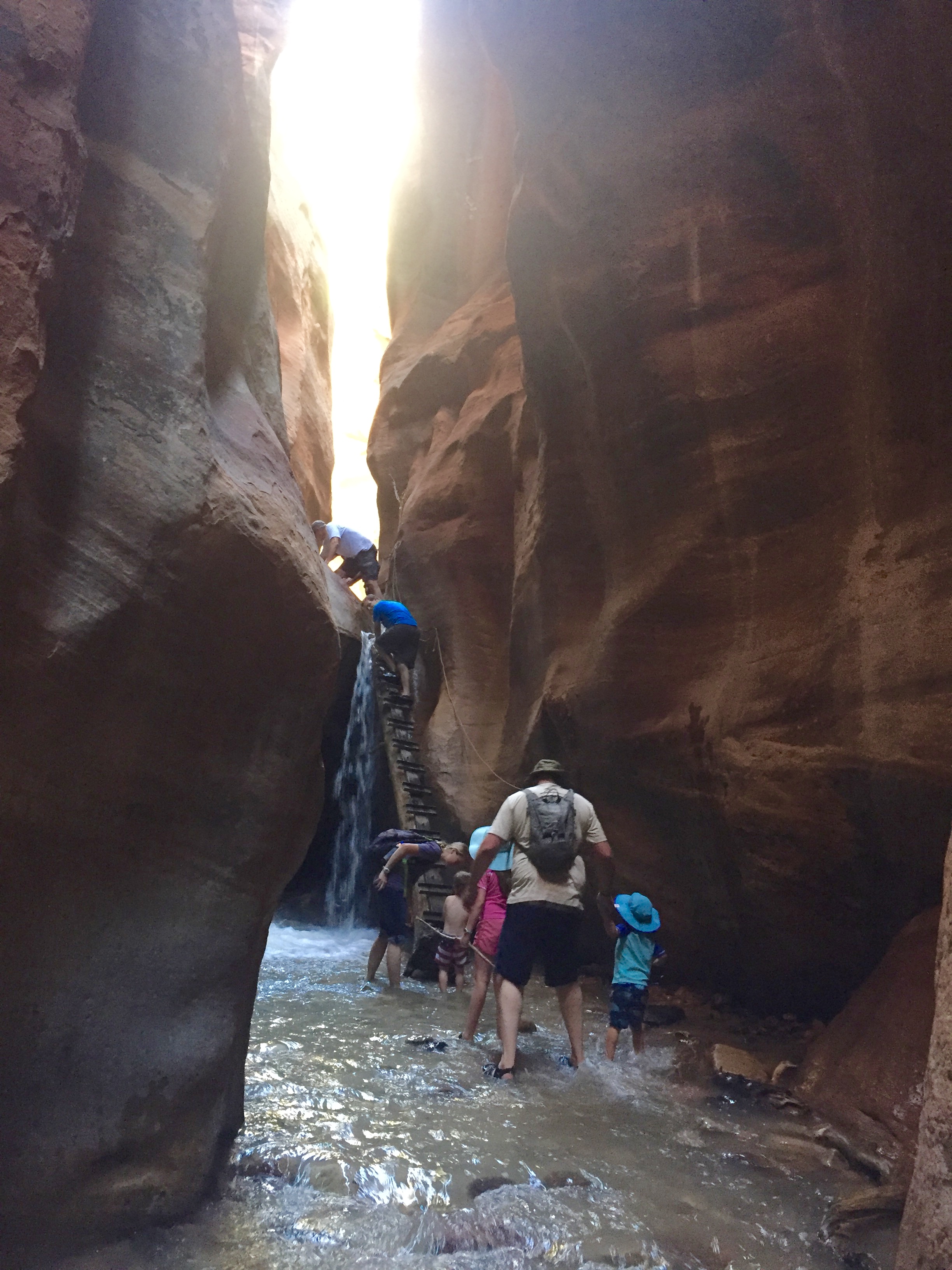
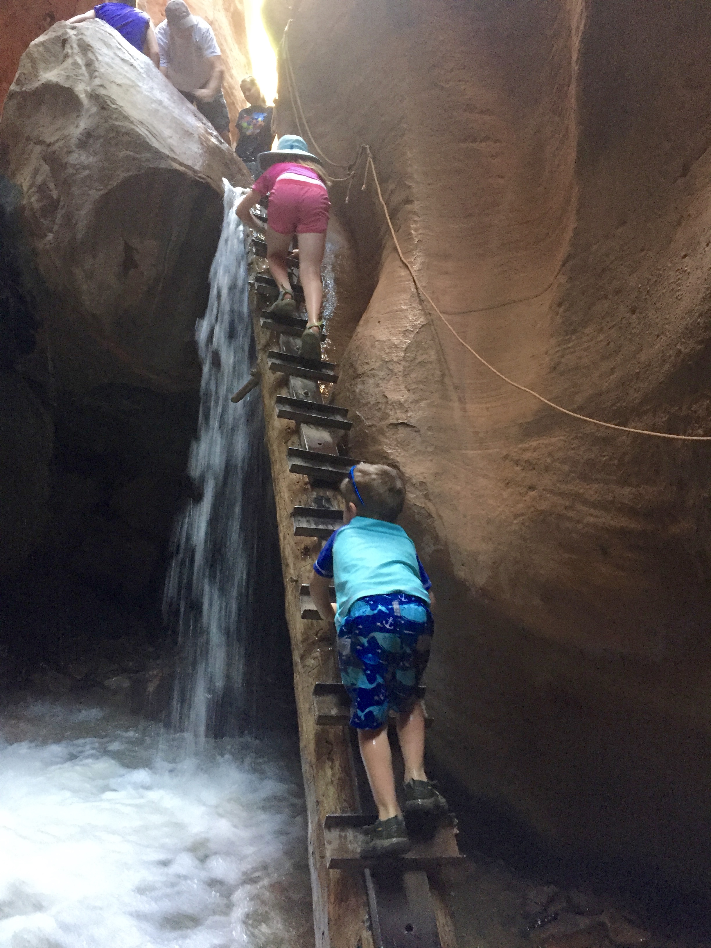
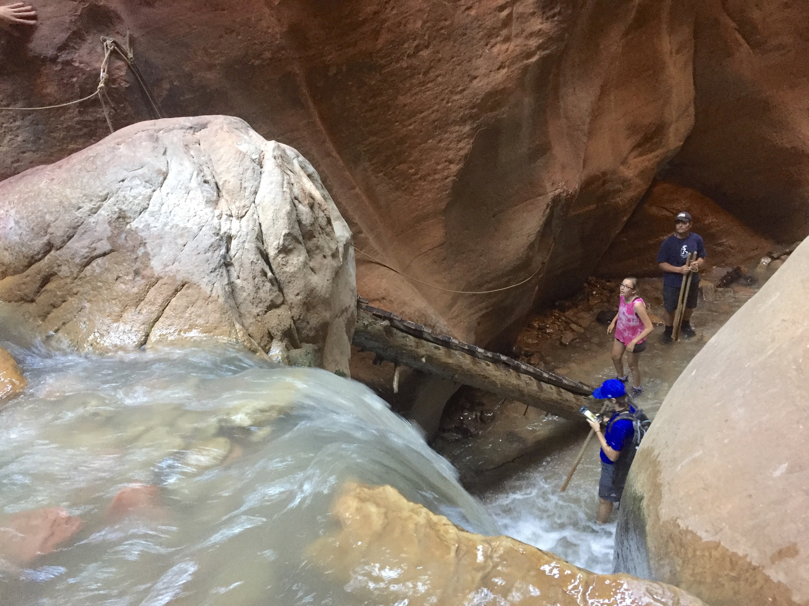
It’s quite dim in the slot canyon, but enough sunshine filters down to make it easy to see the rungs of the ladder. The ladder itself was a bit sketchy in appearance (metal pieces attached to a log with water running all around it), though solid to the touch. A rope attached to the rock wall next to the ladder added some security, especially while maneuvering on and off the ladder.
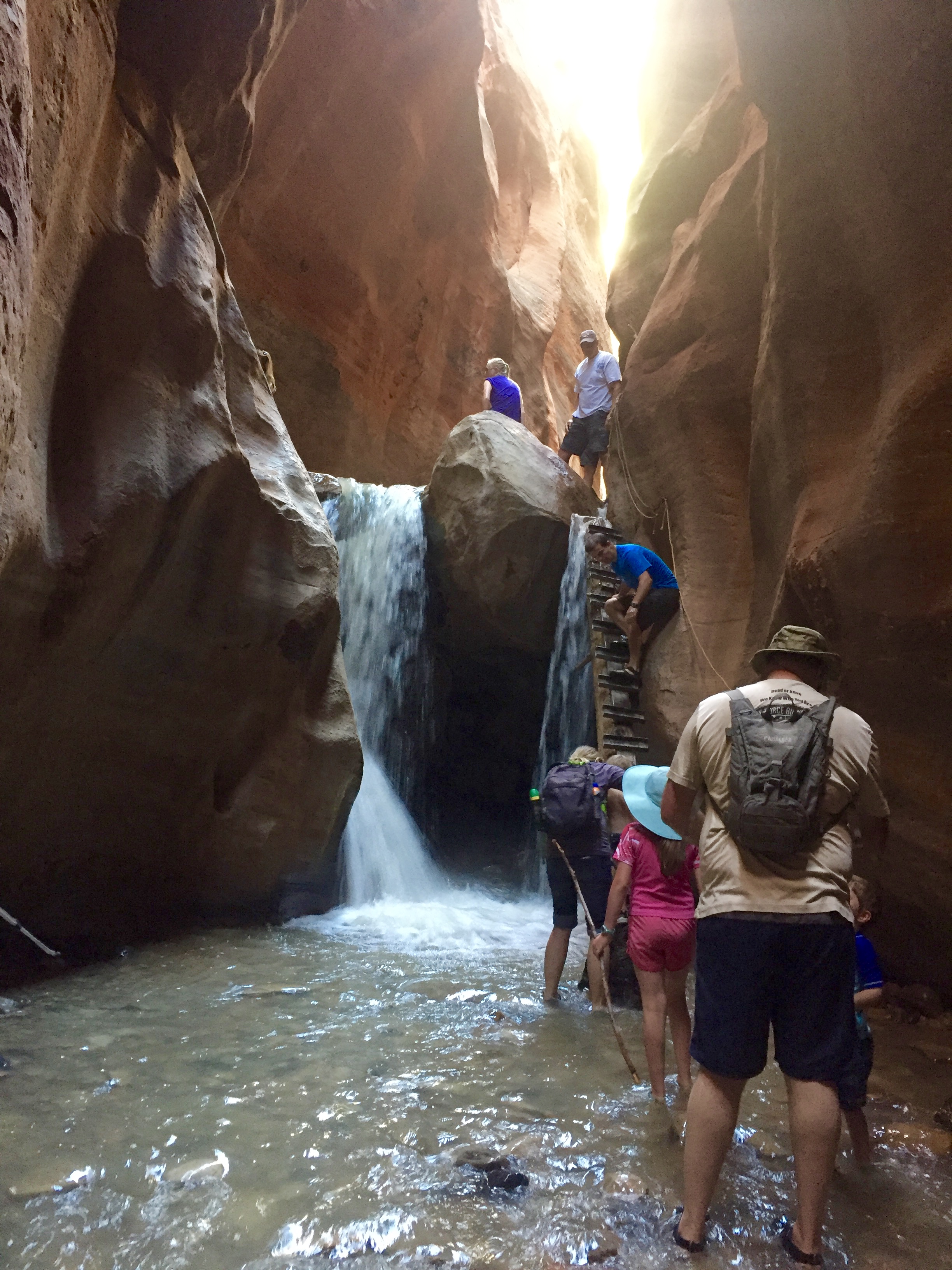
Just past the lower falls was a shorter falls that didn’t have a ladder. I’m confident we could have gotten up it, but I was concerned about coming back down- it looked too slippery, without any good foot or hand holds. With Ocean on my back I didn’t feel safe in such a potentially slippery position. If we’d continued on, there’s an upper falls with a rope ladder, and the trail continues further up the mountain.
As we were turning away from the shorter falls to head back down the ladder, River slipped and fell facedown in the frigid water, knocking out both his breath and his positive attitude. Jeremy carried him out of the slot canyon, but it took awhile for him to warm up and feel like himself again.
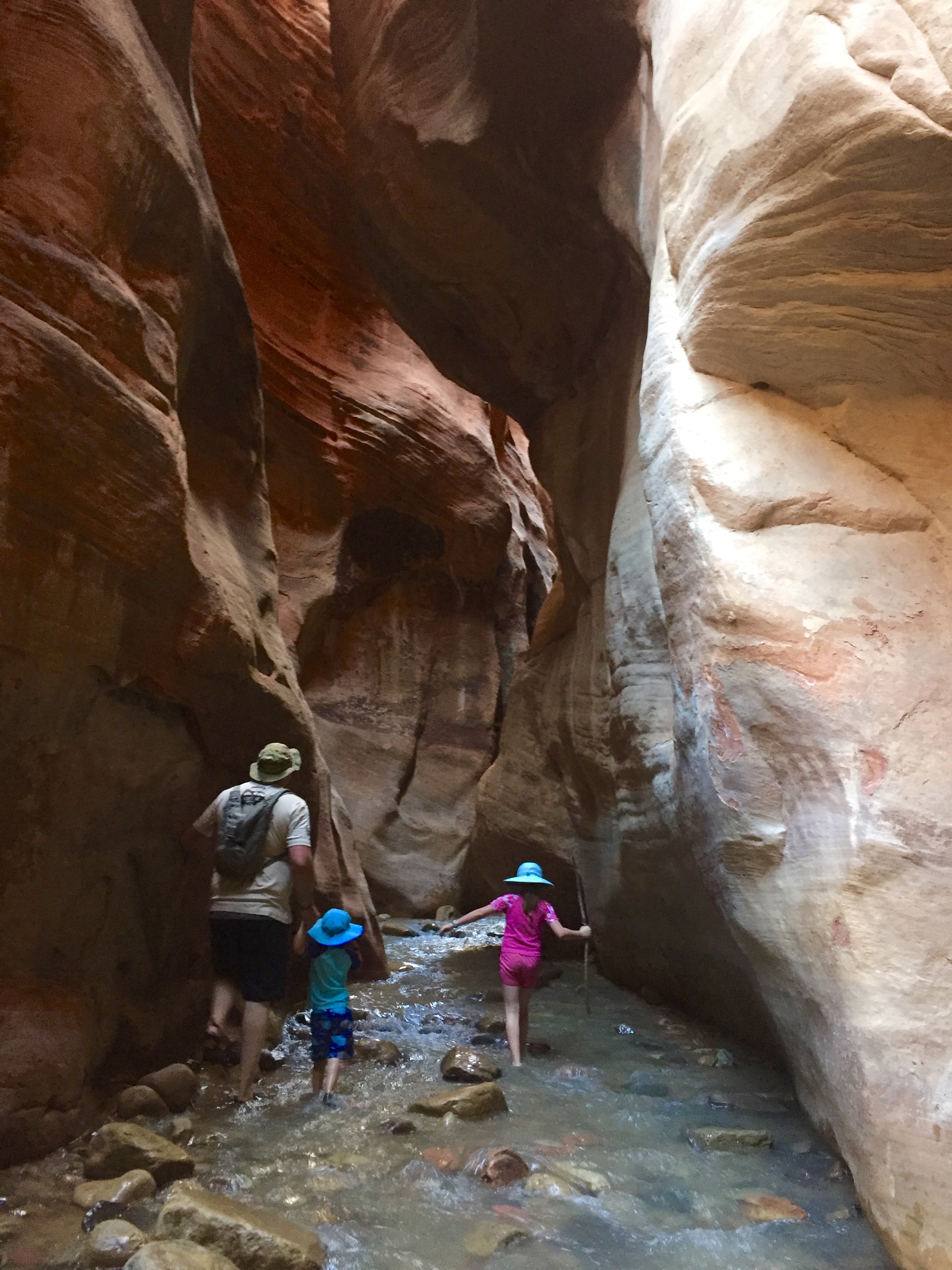
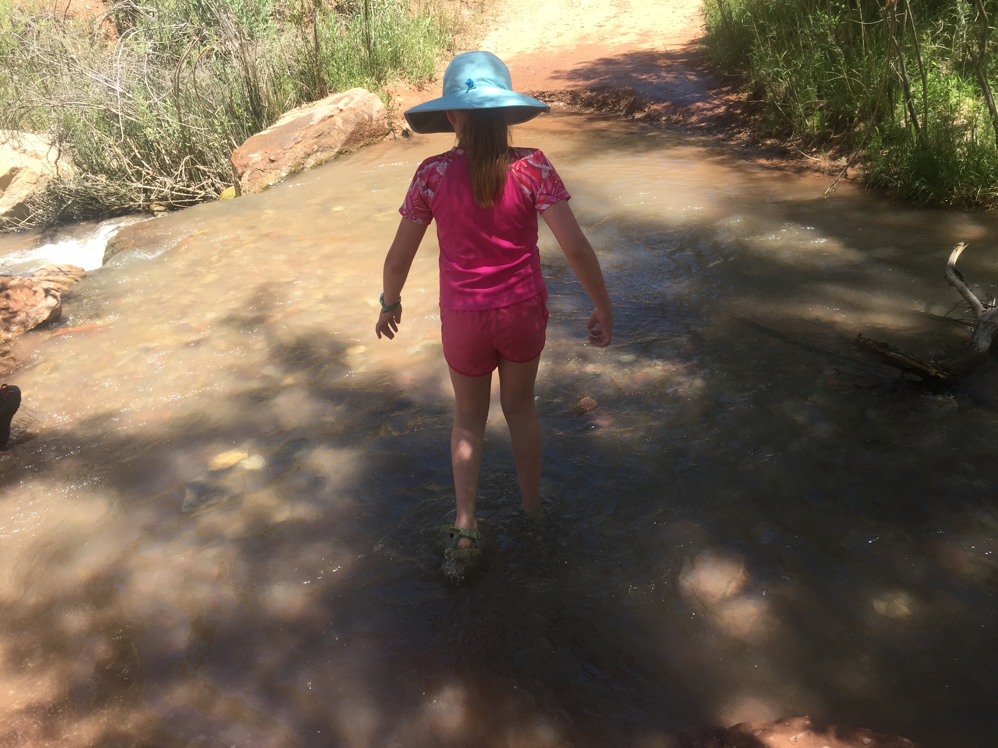
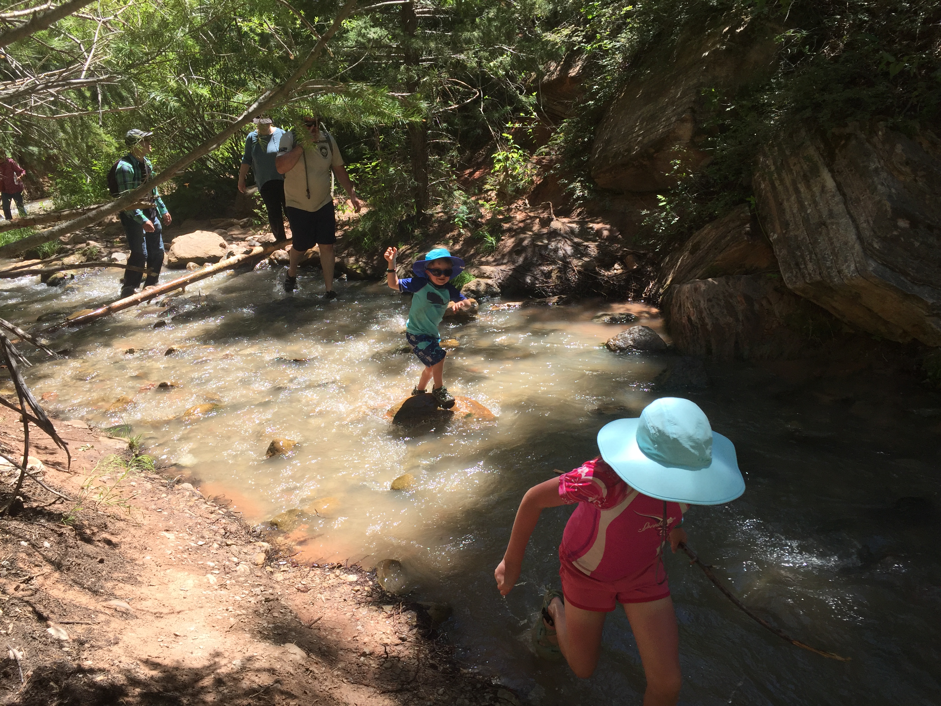
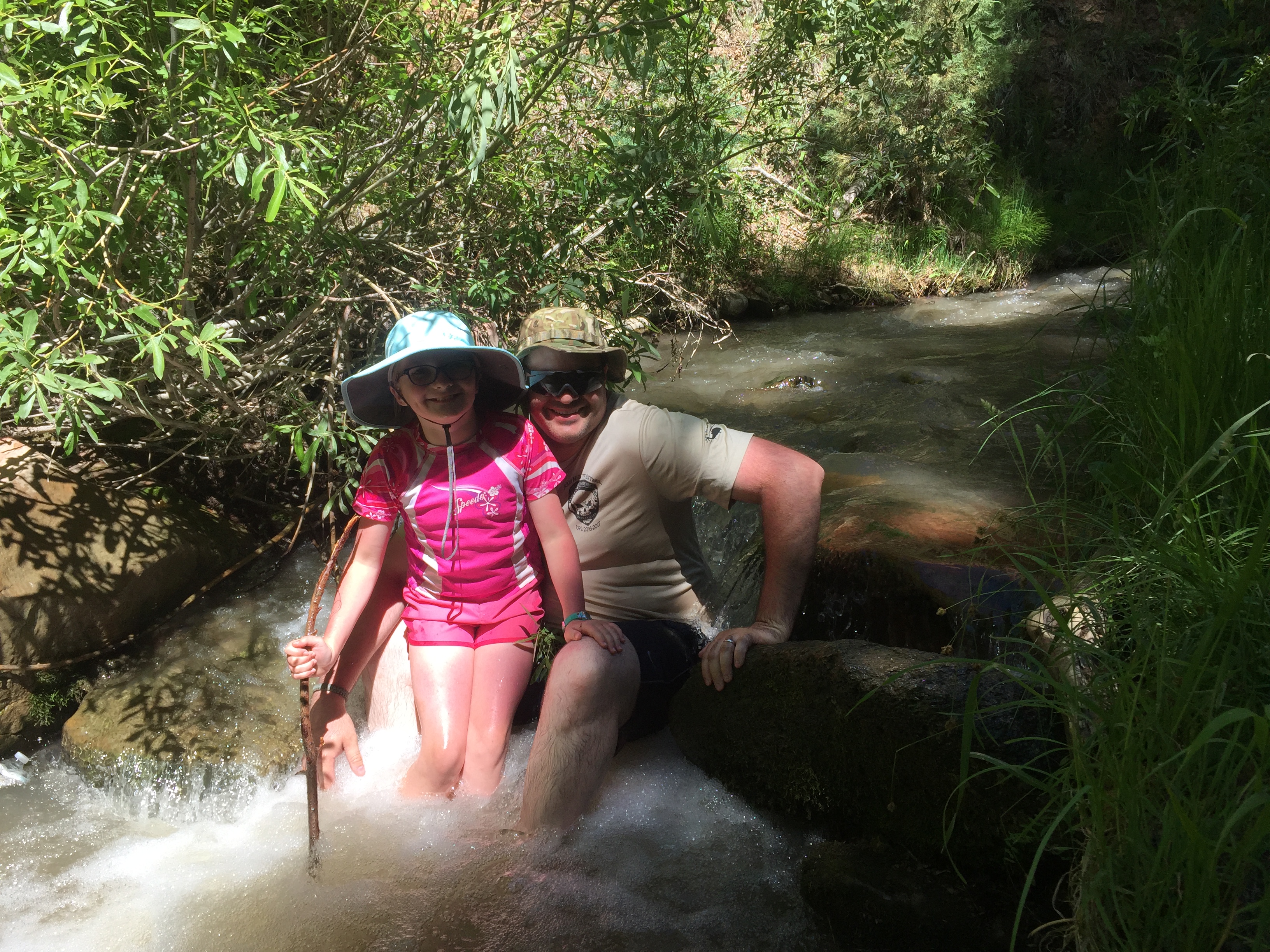
Despite that bit of drama, we all climbed down the ladder safely and headed downstream. Sunshine and I kept to the water as much as possible, while Mr M and River kept to the dryer trail when possible.
I was worried about the rocks being slippery, but because it’s a seasonal river/stream, there really wasn’t any algae or plant life growing on the rocks. This was good, since I hadn’t brought my trekking poles with me. I don’t always have the best balance, but I didn’t have a problem on this hike, except for one time.
Sunshine had found a deeper section of the stream, so I turned back to go in it and while in it I twisted and lost my balance as my shoe slipped off the rock I was standing on. I bashed my shin on a rock and splashed water on my Garmin (mine is old and not made anymore, but this one looks like a great alternative with a lot more functionality) and my phone. I scraped my shin and got a nice bruise, but my Garmin and my phone (I had it out to take pictures) came out fine. My Garmin is a little water resistant and it didn’t get submerged, so it survived fine, and my phone was safely encased in its Lifeproof case, which is waterproof. Ocean’s foot got wet, but that was it.
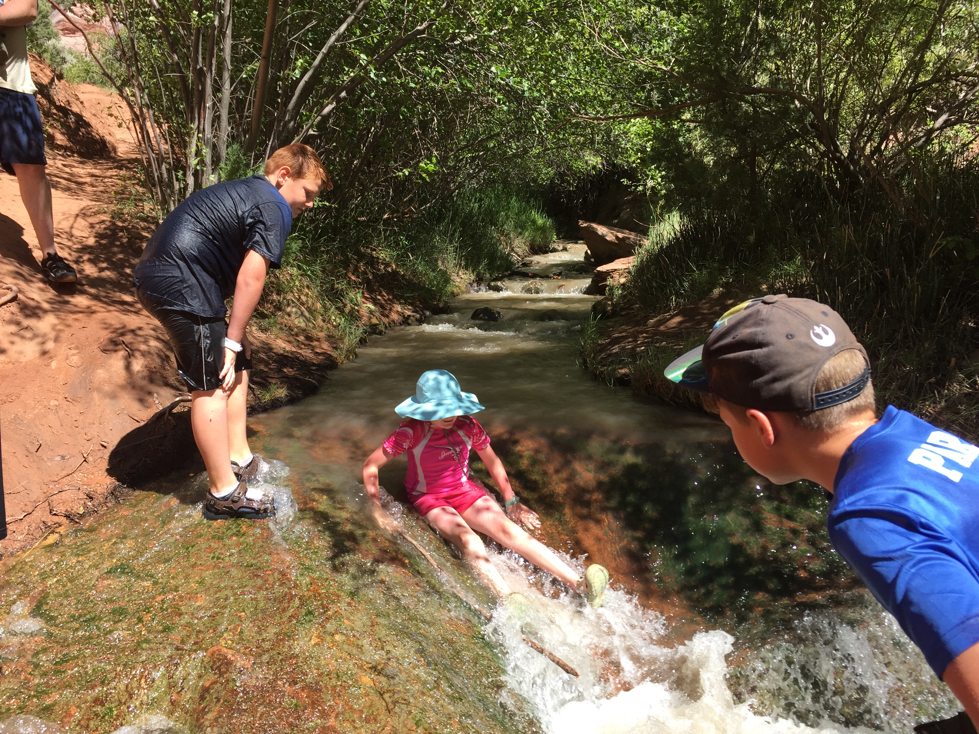
We’d hoped to find a waterfall that you could slide down, but we were unsuccessful in that search. On our way back down Sunshine kept trying to slide down various rocks that looked promising but weren’t. We came across a family sliding down this short chute and Sunshine had to give it a try as well and was happy to be able to successfully slide down it.
Despite River’s dunking and my shin-bashing, we had a great time and would totally recommend this hike to anyone in the area at the right time of year (we were there the middle of June). We plan on doing this hike again when the boys are older and better able to climb around independently so we can go to the upper falls.
A couple recommendations:
Wear Keen sandals. I know a lot of people love their Tevas and Chacos, but the covered toe of Keen sandals is invaluable on a hike with so many rocks. Our toes would not have come out feeling good if we’d had on open-toed shoes.
Don’t wear running shoes or hiking boots. We saw a lot of people doing this and at the beginning they were trying to keep their shoes dry, but it’s a losing battle. Sometimes the trail runs parallel to the stream, but other times there is no other option than to walk in the stream. Your shoes will get sopping wet, there’s no way around it.
Wear quick drying clothes. Even if you don’t plan on getting wet (the water is very cold, after all), you will most likely get wet while climbing the ladder(s). We wore swimsuits and rash guards.
Bring water. The first and last portions of the hike are out in the open, under the beating sun. Hats are a good idea as well. (Sunshine’s hat, my hat, and Ocean and River’s hats)
The hike is longer than you think. It should have been about 3.2 miles round trip from the lower falls, but my Garmin measured the distance at right about 5 miles. Admittedly, we did go a little above the falls, and it’s hard to be sure about the accuracy of the distance measured as I lost satellite reception a couple times in the slot canyon.
On the other hand, we heard it could take 4 or 5 hours to complete the hike, but it only took us just over 3 hours, and that was going the speed of a 3 year old. We did see several people that looked out of shape, and they were struggling, but if you’re in ok shape you’ll be fine. Jeremy has been very sedentary this past year due to his crazy long work hours, and while he was sore the next day, he did fine on the actual hike, even while carrying River.
Be prepared to pay for parking. There’s a lot owned by the town that’s right by the trail head, but we parked a tiny bit further down the road in the lot operated by The Sweet Spot because it was bigger and had more than enough room for us to turn the RV around without any problems (the town lot looked too cramped for our RV, especially since we were towing the car). Both lots charge $10 a car.
If you do go on this hike, please be respectful of the area. I found this article talking about the impact the thousands and thousands of visitors are having on the small town of Kanarraville and their water supply. I had no idea this hike was so popular and just how many people visited until I read this article, and I can totally understand the townspeople’s concerns.
Have you done this hike? What did you think?
Want to join the 52 Hike Challenge? It’s not too late. The 52 Hike Challenge does not operate on a calendar year, so you can sign up at any time throughout the year, and you have 12 months to complete 52 hikes. Sign up using my link and I’ll earn a small commission at no additional charge to you. You can also click on the 52 Hike Challenge image in the right sidebar.